Maryland's History
Pre-Colonial History
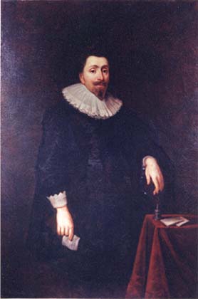 George Calvert, 1st Baron Baltimore, applied to Charles I for a royal charter for what was to become the Province of Maryland. After Calvert died in April 1632, the charter for "Maryland Colony" was granted to his son, Cecilius Calvert, 2nd Baron Baltimore, on June 20, 1632.
The colony was named in honor of Queen Henrietta Maria, the wife of King Charles I. Led by Leonard Calvert, Cecil Calvert's younger brother, the first settlers departed from Cowes, on the Isle of Wight, on November 22, 1633 aboard two small ships, the Ark and the Dove. Their landing on March 25, 1634 at St. Clement's Island in southern Maryland, is commemorated by the state each year on that date as Maryland Day. This was the site of the first Catholic mass in the Colonies, with Father Andrew White leading the service. The first group of colonists consisted of 17 gentlemen and their wives, and about two hundred others, mostly indentured servants who could work off their passage.
After purchasing land from the Yaocomico Indians and establishing the town of St. Mary's, Leonard, per his brother's instructions, attempted to govern the country under feudalistic precepts. Meeting resistance, in February 1635, he summoned a colonial assembly. In 1638, the Assembly forced him to govern according to the laws of England. The right to initiate legislation passed to the assembly.
In 1638, Calvert seized a trading post in Kent Island established by the Virginian William Claiborne. In 1644, Claiborne led an uprising of Maryland Protestants. Calvert was forced to flee to Virginia, but he returned at the head of an armed force in 1646 and reasserted proprietarial rule.
Maryland soon became one of the few predominantly Catholic regions among the English colonies in North America. Maryland was also one of the key destinations where the government sent tens of thousands of English convicts punished by sentences of transportation. Such punishment persisted until the Revolutionary War.
The founders designed the city plan of the colonial capital, St. Mary's City, to reflect their world view. At the center of the city was the home of the mayor of St. Mary's City. From that point, streets were laid out that created two triangles. Located at two points of the triangle extending to the west were the first Maryland state house and a jail. Extending to the north of the mayor's home, the remaining two points of the second triangle were defined by a Catholic church and a school. The design of the city was a literal separation of church and state that reinforced the importance of religious freedom. The largest site of the original Maryland colony, St. Mary's City was the seat of colonial government until 1708.
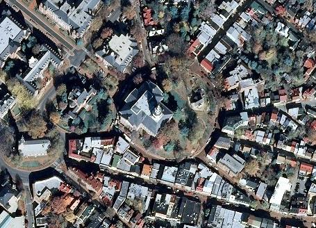 Because Anglicanism had become the official religion in Virginia, a band of Puritans in 1642 left for Maryland; they founded Providence (now called Annapolis). In 1650, the Puritans revolted against the proprietary government. They set up a new government prohibiting both Catholicism and Anglicanism. In March 1655, the 2nd Lord Baltimore sent an army under Governor William Stone to put down this revolt. Near Annapolis, his Roman Catholic army was decisively defeated by a Puritan army in the Battle of the Severn. The Puritan revolt lasted until 1658, when the Calvert family regained control and re-enacted the Toleration Act. The Puritan revolutionary government persecuted Maryland Catholics during its reign. Mobs burned down all the original Catholic churches of southern Maryland. In 1708, the seat of government was moved to Providence, renamed Annapolis in honor of Queen Anne. St. Mary's City is now an archaeological site, with a small tourist center. Just as the city plan for St. Mary's City reflected the ideals of the founders, the city plan of Annapolis reflected those in power at the turn of the 18th century. The plan of Annapolis extends from two circles at the center of the city – one including the State House and the other the Anglican St. Anne's Church (now Episcopal). The plan reflected a stronger relationship between church and state, and a colonial government more closely aligned with the Protestant church.
 Tobacco was the main export crop in the colonial era; it involved a great deal of hand labor, usually done by slaves, the original royal charter granted Maryland the Potomac River and territory northward to the fortieth parallel. This was found to be a problem, as the northern boundary would have put Philadelphia, the major city in Pennsylvania, within Maryland. The Calvert family, which controlled Maryland, and the Penn family, which controlled Pennsylvania, decided in 1750 to engage two surveyors, Charles Mason and Jeremiah Dixon, to establish a boundary. They surveyed what became known as the Mason–Dixon Line, which became the boundary between the two colonies. The crests of the Penn family and of the Calvert family were put at the Mason–Dixon line to mark it. Later the Mason–Dixon line was used as a boundary between free and slave states under the Missouri Compromise of 1820.
Maryland's History in Time
From 1763 to 1767, Charles Mason and Jeremiah Dixon surveyed Maryland's northern boundary line with Pennsylvania. In 1791, Maryland ceded land to form the District of Columbia.
In 1814, during the British attempt to capture Baltimore, the bombardment of Fort McHenry inspired Francis Scott Key to write the words to “The Star-Spangled Banner.” During the Civil War, Maryland was a slave state but remained in the Union. Consequently, Marylanders fought on both sides and many families were divided.
Maryland's Eastern Shore and Western Shore embrace the Chesapeake Bay, and the many estuaries and rivers create one of the longest waterfronts of any state. The Bay produces more seafood—oysters, crabs, clams, fin fish—than any comparable body of water. Since the 1950s, fish stocks have declined due to increased residential and commercial development in the area and the attendant amount of nutrients, sediment, and toxic substances polluting the water. In 2009, President Barack Obama signed the Chesapeake Bay Restoration and Protection Executive Order that called on the federal government "to restore and protect the nation's largest estuary and its watershed."
Maryland and the War of 1812
The War of 1812 was a 32-month military conflict between the United States of America and the United Kingdom of Great Britain and Ireland, its North American colonies and its Indian allies. The outcome resolved many issues which remained from the American War of Independence, but involved no boundary changes.
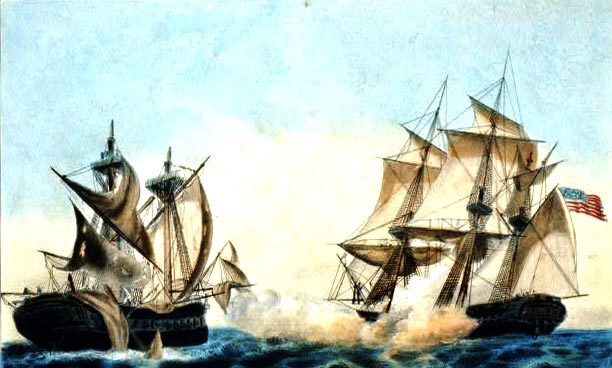
The United States declared war in 1812 for several reasons, including trade restrictions brought about by Britain's continuing war with France, the impressment of American merchant sailors into the Royal Navy, British support of American Indian tribes against American expansion, outrage over insults to national honor after humiliations on the high seas, and possible American interest in annexing British North American territory (part of modern-day Canada) which had been denied to them in the settlement ending the American Revolutionary War.
During the War of 1812 the British conducted raids against cities along Chesapeake Bay, up to and including Havre de Grace. There were also two notable battles that occurred in the state. The first was the Battle of Bladensburg, which occurred on August 24, 1814 just outside the national capital, Washington, D.C. The militiamen defending the city were routed and retreated in confusion through the streets of the city. After overrunning the confused American defenders at Bladensburg, the British took Washington, D.C. They burned and looted major public buildings, forcing President James Madison to flee to Brookeville, Maryland.
Battle of North Point Monument (dedicated 1815), ca. 1870–1875, which appears on both the flag and the seal of Baltimore, Maryland The British marched next to Baltimore, where they hoped to strike a knockout blow against the demoralized Americans. Baltimore was not only a busy port, but the British thought it harbored many of the privateers who were despoiling British ships. The city's defenses were under the command of Major General Samuel Smith, an officer of Maryland militia and a United States senator. Baltimore had been well fortified with excellent supplies and some 15,000 troops. Maryland militia fought a determined delaying action at the Battle of North Point, during which a Maryland militia marksman shot and killed the British commander, general Robert Ross. The battle bought enough time for Baltimore's defenses to be strengthened.
After advancing to the edge of American defenses, the British halted their advance and withdrew. With the failure of the land advance, the sea battle became irrelevant and the British retreated.
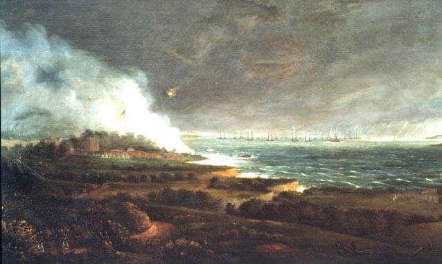
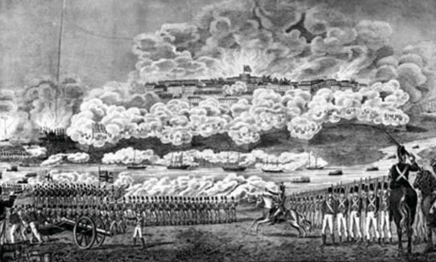
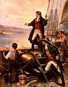
At Fort McHenry, some 1000 soldiers under the command of Major George Armistead awaited the British naval bombardment. Their defense was augmented by the sinking of a line of American merchant ships at the adjacent entrance to Baltimore Harbor in order to thwart passage of British ships. The attack began on the morning of September 13, as the British fleet of some nineteen ships began pounding the fort with rockets and mortar shells. After an initial exchange of fire, the British fleet withdrew just beyond the 1.5 miles (2.4 km) range of Fort McHenry's cannons. For the next 25 hours, they bombarded the outmanned Americans. On the morning of September 14, an oversized American flag, which had been raised before daybreak, flew over Fort McHenry. The British knew that victory had eluded them. The bombardment of the fort inspired Francis Scott Key, a native of Frederick, Maryland, to write "The Star-Spangled Banner" as witness to the assault. It later became the country's national anthem.
Maryland felt the naval impact of the War of 1812 as well as the physical impact of a foreign invasion. For much of the war, the British Navy blockaded America's ports up and down the coast, hurting towns such as Baltimore that depended on trade. Baltimoreans fought back in the small, fast ships local shipbuilders had designed, causing the British to brand Baltimore "a nest of pirates" and forbid direct confrontation with American ships. During the middle years of the war, Rear Admiral Sir George Cockburn conducted raids on the Chesapeake Bay coast.
Battle of Bladensburg
On August 24th, 1814, Cockburn fought a series of engagements on the Patuxent River against Commodore Joshua Barney's flotilla of gunboats and armed, shallow-draft barges. Shortly before Barney was forced to scuttle his vessels, Major General Robert Ross landed an expeditionary force of British soldiers and marines in Benedict (Charles County) and marched in the direction of Washington.
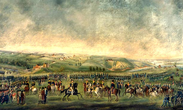
On August 24, 1814, American troops defending the capital under Brigadier General William Winder were defeated by the British at the Battle of Bladensburg (Prince George's County), which allowed the capture and burning of Washington, D.C.
Battle of Baltimore
The British then sailed up the Chesapeake to Baltimore. There a land invasion was halted on September 12, 1814 at the Battle of North Point, east of Baltimore City in Dundalk. By sea, the harbor mouth was protected by Fort McHenry, which sustained a heavy bombardment from the British Navy September 13 through the morning of the 14th.
Upon seeing that the American flag still flew over the fort on September 14th, native Maryland lawyer Francis Scott Key was inspired to write the poem "The Star-Spangled Banner," which later became the national anthem of the United States. Following their defeat, the British withdrew from the Chesapeake Bay.

No comments:
Post a Comment